
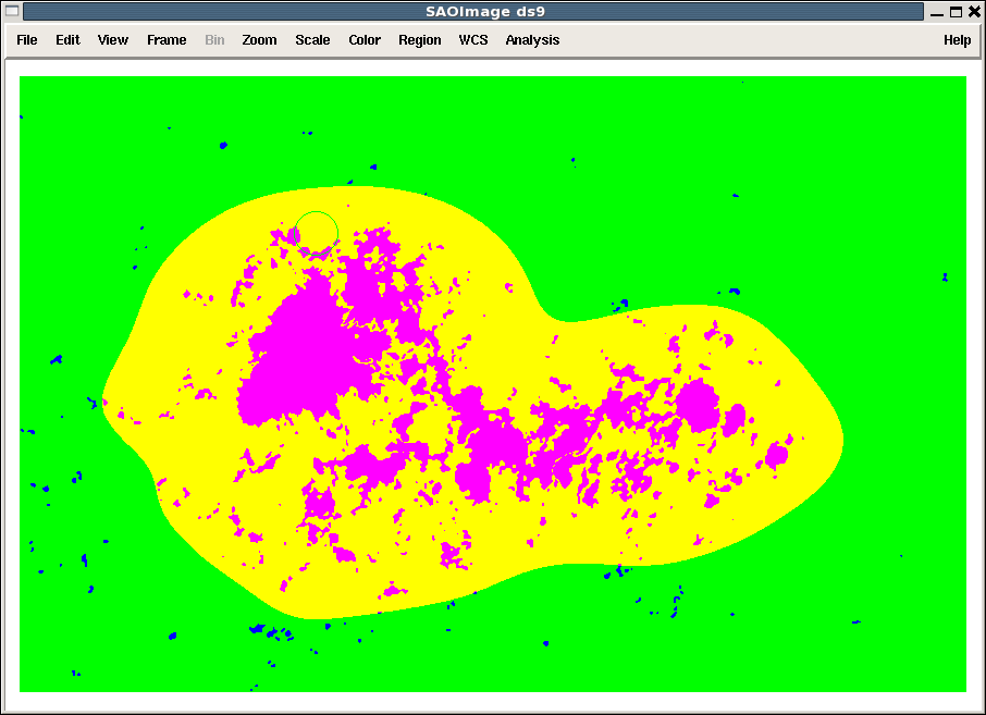
Bitmap of HARP 1638, NOAA AR 11463
The map below shows the pixels inside the bounding box for HARP 1638 that are the data segment BITMAP for hmi.Mharp_720s[1638][2012.05.09_10:00:00_TAI]
The bounding box is as large as it is because during the HARPs disk passage it reached that maximum extent in heliographic coordinates. The maximum extent is projected to the current location. The CCD coordinates of the lower left are given by keywords CRPIX1 and CRPIX2 and the size of the box is given by CRSIZE1 and CRSIZE2.
Bitmap Values
Each pixel has a value that indicates it's status. The values are derived from the full disk instantaneous mask in hmi.Marmask_720s. Values 33 and higher are part of the HARP at this point in time.
- This region is near disk center, so none of the pixels has the off-limb value = 0.
- On-disk quiet pixels (value=1), are shown in green. They are outside of the HARP and have small enough magnetic field (size or area) that they are not identified as active.
- Active blue pixels outside the HARP have value = 2. These active pixels are not big enough or close enough to the main flux concentration to be part of the HARP.
Quiet pixels inside the HARP boundary have value = 33 and are shown in yellow. The HARP boundary is determined using the method described at ARmaskDataSeries. The boundary shifts in time depending on the evolving characteristics of the field. The HARP boundary is smooth and regular.
- Magenta active pixels inside the HARP have the value 34.
http://sun.stanford.edu/~todd/jsoc-wiki/Bitmap1638.20120509_1000.png
Return to HARPDataSeries